Overview
Week 14 marked a significant milestone in the project: synthesizing all accumulated field research data from 13 Singapore districts into an interactive 3D spatial experience. This prototype represents the culmination of weeks of noise documentation, transforming abstract acoustic data into a navigable virtual environment.
The goal was to create a system where users could move through a 3D representation of Singapore and experience the sonic character of different locations indirectly through spatial exploration. Rather than simply viewing data visualizations, users would inhabit a virtual space where noise becomes an atmospheric quality embedded in the geography itself.
From Data to Spatial Experience
The challenge was transforming the comprehensive field research documentation from Week 13 into an experiential prototype. Each of the 13 districts had been analyzed for sonic qualities, environmental characteristics, and acoustic patterns. The question became: how can this research be experienced rather than simply read?
The solution involved creating a three-dimensional map of Singapore where users could navigate between districts and encounter the acoustic character of each location through visual-spatial representation. By integrating geographic data with noise measurements, the prototype aimed to make the invisible sonic landscape visible and explorable.
Technical Development Process
The development process involved multiple technical stages, integrating 3D modeling, geographic data, and web-based interaction. Each component required careful consideration to ensure the final prototype would be both technically functional and conceptually coherent.
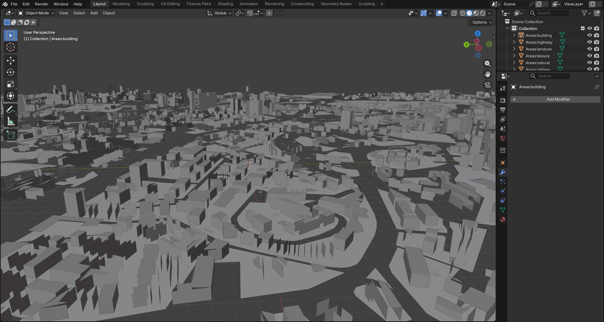
Stage 1: 3D Modeling in Blender
The first stage involved creating a three-dimensional model of Singapore's geography using Blender. This process required translating geographic data into 3D geometry that could accurately represent the city's spatial relationships while remaining optimized for real-time navigation.
The modeling process focused on capturing Singapore's distinctive urban topology, creating a base layer that would serve as the foundation for overlaying noise data. The 3D model needed to balance geographic accuracy with aesthetic clarity, ensuring users could recognize locations while maintaining visual coherence.
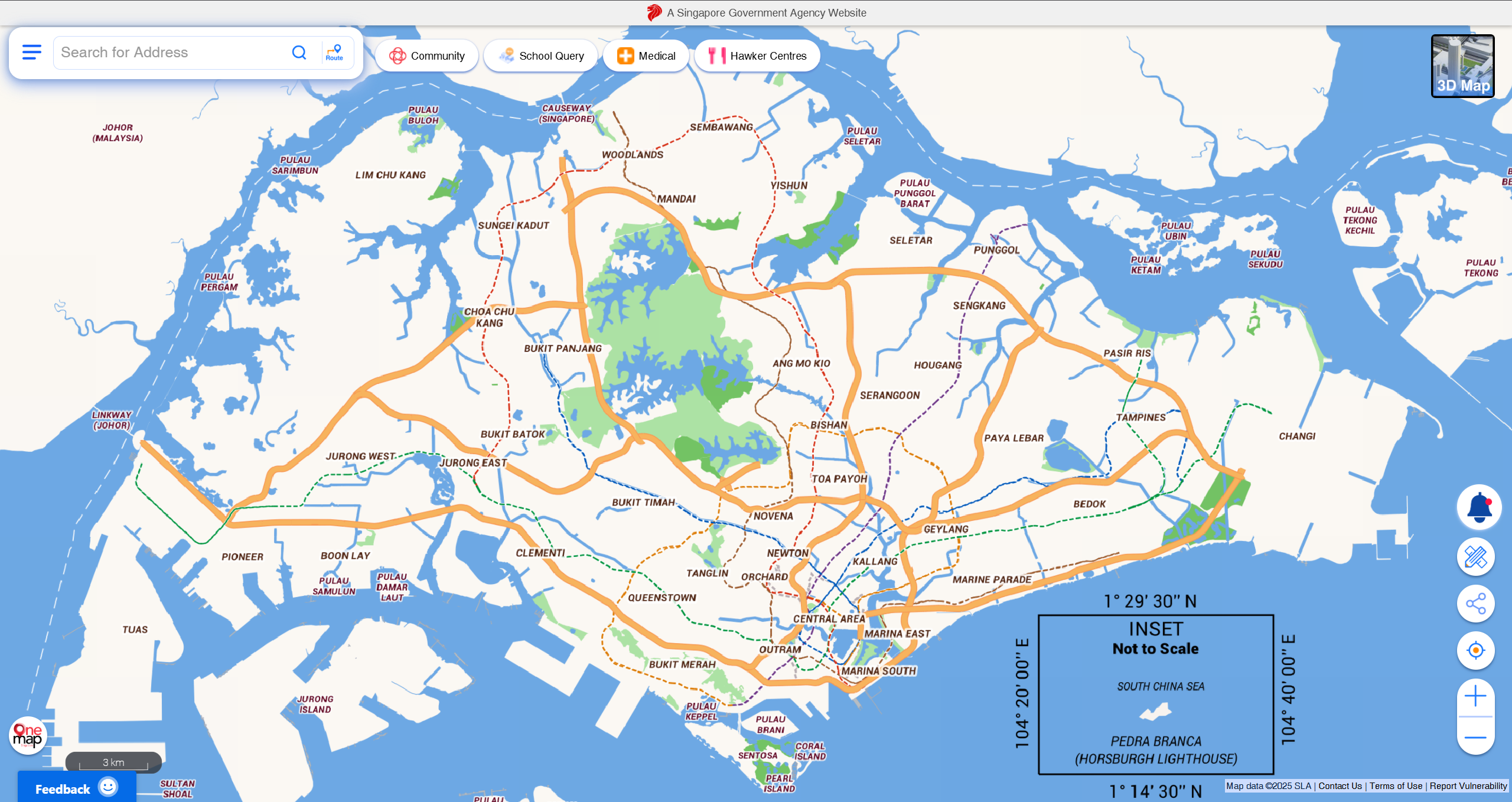
Stage 2: Google Earth API Integration
The second stage involved integrating the 3D model with Google Earth API to provide geographic context and real-world spatial reference. This integration allows users to understand the relationship between the abstract noise data and actual physical locations in Singapore.
By connecting the custom 3D model with Google Earth's geographic information system, the prototype creates a hybrid space where artistic representation meets cartographic precision. Users can navigate between abstracted noise visualization and concrete geographic reality.
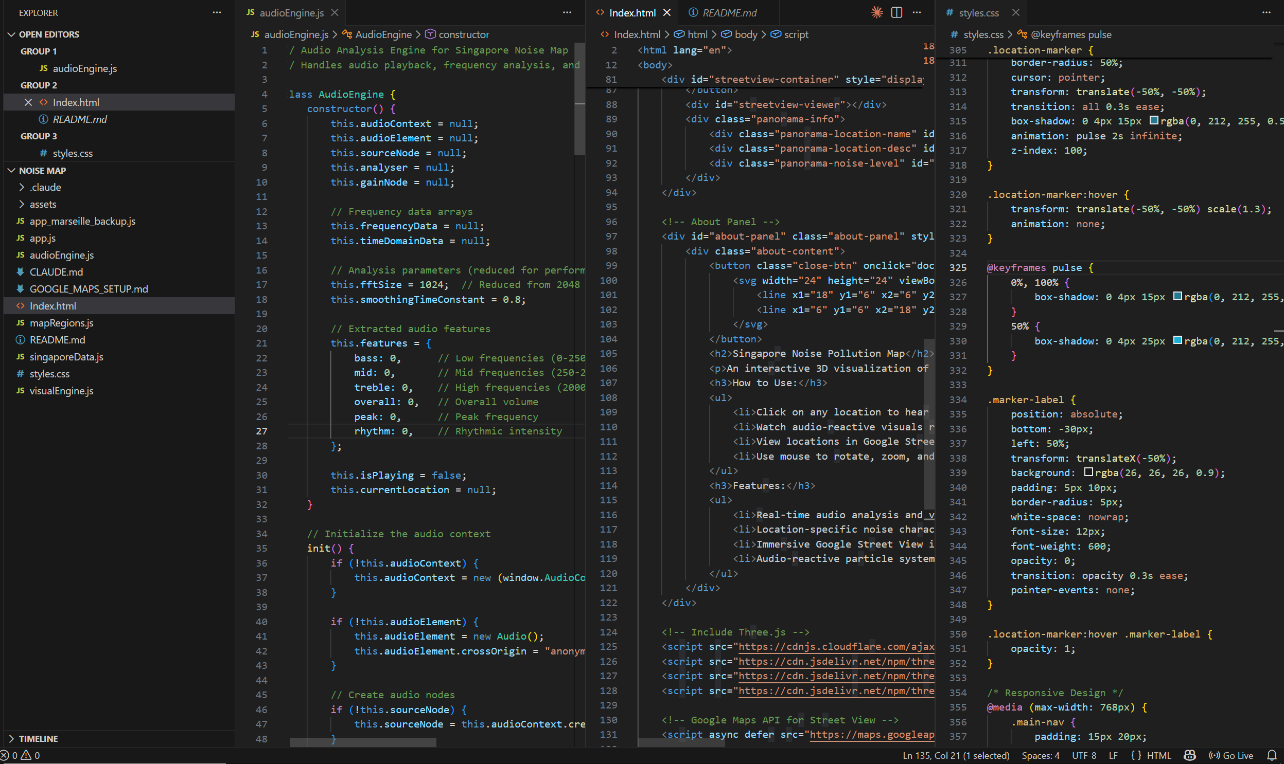
Stage 3: Development Environment Setup
The technical implementation was developed in Visual Studio Code, creating a web-based interactive environment that could render the 3D model and handle user navigation. This stage involved setting up the development framework, configuring API connections, and building the interaction logic.
The development environment needed to support real-time 3D rendering, smooth navigation controls, and dynamic data loading. The goal was creating a seamless experience where users could move through the virtual space intuitively, encountering noise data as they explore different districts.
Designing the Interactive Experience
Beyond the technical infrastructure, the prototype required careful consideration of how users would experience and understand the noise data through spatial navigation. The interaction design focused on making the exploration intuitive while revealing the complexity of Singapore's acoustic landscape.
Navigation and Spatial Movement
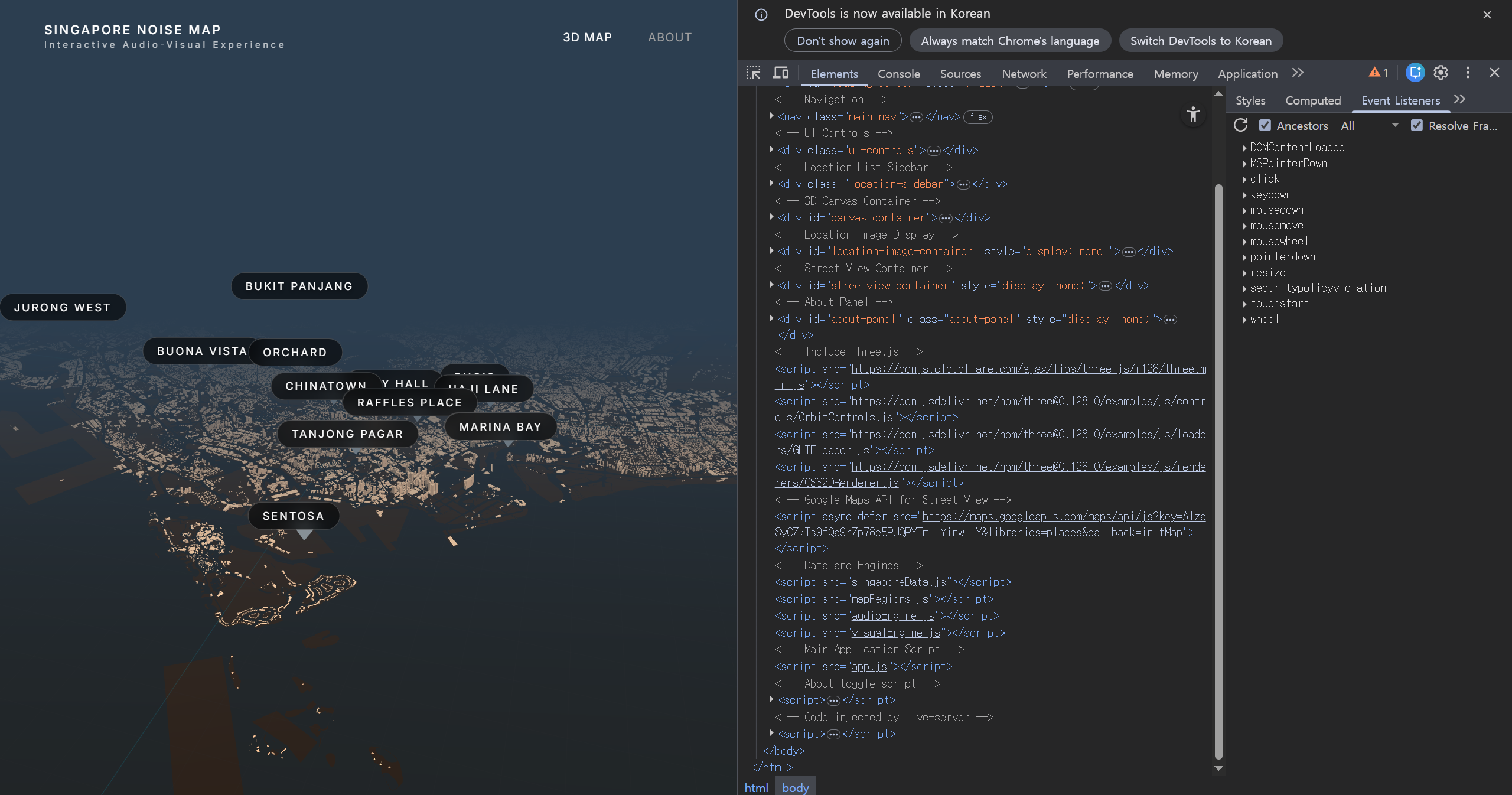
Users can move through the 3D space freely, traveling between the 13 documented districts. As they navigate, the environment responds to their location, revealing the sonic character of each area through visual-spatial cues embedded in the geography.
The navigation system allows for both bird's-eye overview (understanding the overall distribution of noise across Singapore) and ground-level exploration (experiencing the specific acoustic qualities of individual locations). This multi-scale approach supports different modes of engagement with the data.
Indirect Noise Experience
Rather than directly playing recorded sounds or showing numerical decibel readings, the prototype represents noise through spatial and visual qualities. The acoustic character of each district becomes embedded in the virtual environment itself, creating an indirect but visceral sense of each location's sonic identity.
This approach aligns with the project's core philosophy: transforming noise from pollution into aesthetic material. By making noise a spatial property rather than an auditory annoyance, the prototype reframes how we perceive and value urban sound.
Reflection: From Documentation to Experience
This prototype represents a crucial transition in the project from documentation to experience design. While previous weeks focused on gathering data, analyzing patterns, and experimenting with representation methods, Week 14 synthesized these explorations into an interactive system that invites embodied engagement.
The 3D map prototype demonstrates that noise data need not remain abstract or purely informational. By situating acoustic measurements within navigable virtual space, the work creates opportunities for intuitive understanding and aesthetic appreciation of Singapore's sonic landscape.
The integration of Blender modeling, Google Earth API, and web-based interaction technologies shows how diverse technical tools can be orchestrated to serve a unified conceptual vision. Each technical decision supports the broader goal: making the invisible landscape of urban noise visible, tangible, and explorable.
Technical Challenges and Solutions
Developing the interactive 3D prototype presented several technical challenges that required creative problem-solving and iterative refinement.
- 3D Model Optimization: Balancing geographic detail with rendering performance to ensure smooth navigation
- API Integration: Connecting custom 3D models with Google Earth's geographic coordinate system
- Data Mapping: Translating acoustic measurements into spatial-visual parameters that communicate effectively
- User Interface Design: Creating intuitive navigation controls that don't distract from the spatial experience
- Cross-Platform Compatibility: Ensuring the web-based prototype functions across different devices and browsers
Each challenge required research, experimentation, and often multiple iterations to achieve satisfactory results. The development process itself became a form of research, revealing insights about how technical constraints shape creative possibilities.
Experience the Interactive Prototype
The 3D interactive noise map is now available to experience online. Navigate through Singapore's acoustic landscape, explore the 13 documented districts, and discover how noise data transforms into spatial experience.
Singapore 3D Noise Map
Click the link below to launch the interactive prototype in your browser. Use your mouse or trackpad to navigate through the 3D environment and explore different districts.
Opens in a new window
Outcome
Week 14's development of the 3D interactive noise map achieved several important outcomes:
- Successfully synthesized field research from 13 districts into unified spatial system
- Created functional prototype integrating Blender 3D modeling with Google Earth API
- Demonstrated how acoustic data can be experienced through spatial navigation
- Established technical foundation for further iteration and refinement
- Transformed abstract noise measurements into tangible, explorable virtual environment
- Validated the approach of indirect experience design for communicating sonic information
- Deployed interactive web prototype accessible to global audience
The prototype represents a significant step forward in the project, moving from research and documentation to experiential design. The web deployment makes the work accessible to anyone with an internet connection, enabling remote exploration of Singapore's sonic landscape.
Looking Ahead
The final weeks of the semester will focus on:
- Refining the interaction design and user experience of the 3D prototype
- Enhancing the visual representation of noise data within the spatial environment
- Testing the prototype with users to gather feedback and identify improvements
- Integrating audio elements to complement the spatial-visual experience
- Preparing comprehensive documentation and presentation materials
- Reflecting on the entire research process and consolidating key insights